New bus priority measures for Gosforth High Street to be introduced

New bus priority measures are set to be installed on a key bus route to improve public transport.

The following news release was issued by Newcastle City Council:

“Plans are underway to extend the bus lane on the northbound section of Gosforth High Street, with the current bollards removed, within the coming weeks.

One lane of traffic from Moorfield to Salters Road

The immediate plans will see one lane of traffic each way retained through the main stretch of the high street, with bus priority measures and cycling provision where space allows.

This would see bus lane provision extended northbound along Gosforth High Street, from Moorfield towards Salters Road at its junction with Church Road, to improve journey times and bus reliability on one of the busiest routes for public transport from the city.

The plans are part of a phased approach to the High Street which would see bus priority measures installed in the coming weeks, with a second phase looking at the long-term options for this key shopping destination.

The re-allocation of road space would see cycling provision remain in place from Moor Crescent up to St Nicholas Avenue. Cycling provision from St Nicholas Avenue to Salters Road would be removed in the short-term, with longer-term plans to better connect this part of the High Street with more ‘quiet routes’ for cycling on connected side streets as part of a second phase of improvement works. Other longer-term proposals include improvements to public realm space with a parklet for the community to enjoy, improved cycle parking facilities, better-placed and improved bus stops, as well as green infrastructure to improve biodiversity and air quality in the local area.

Cllr Jane Byrne, cabinet member for a connected, clean city said:

“The plans we have put forward greatly improves bus services on a key bus route from the city, removes the bollards which people have asked us to do, as well as develops a long-term future for Gosforth High Street, to make it greener, more accessible and improves the look and feel of a key shopping area in the city.

“We’re taking a phased approach to this high street, with the immediate focus on improving bus priority measures as we want Newcastle to be a clean, connected city and having an efficient public transport network, particularly on one of the major routes from the city, is a key part of this and is part of our priorities to achieve net zero.

“Gosforth High Street is one of the narrowest high streets in the city and we want to make best use of the space available. Increasing the bus lane provision means we won’t be able to widen pavements and provide cycling along the whole of the High Street, so we’ll be looking at improving connectivity for people walking, wheeling and cycling to this important shopping area as part of the next phase of works.

“We’ll be setting out further proposals on the long-term future of the high street soon and I invite everyone to have their say.”

Using Experimental Traffic Regulation Orders (ETROs), it is intended to install the bus priority changes in the coming weeks. Public consultation would take place for the first six months of the scheme being implemented. This would allow the council to trial the scheme and gauge public feedback, as well as ask the public for their views on the long-term future of the High Street.

Journey time data, which has been collected over four years, show that there has been minimal impact on the travelling public with the traffic reduced to two lanes through the High Street. Southbound journey times have improved on the am peak, with no change on the pm peak. Northbound journey times haven’t been affected on the am peak, with a small increase on average on the pm peak.

Bus priority measures, in locations such as the Great North Road, are an essential part of the proposed Enhanced Bus Partnership across the North East region which will see improvements to bus reliability, services and bus fares. 

Information for the public is being prepared, including drop-in events, which will be announced soon, ahead of the scheme being implemented in Spring 2023. The measures could be in place for up to 18 months while the council review the findings from data and public feedback on the scheme, while bidding for the funding to deliver a long-term enhancement to this area.”

The above news story was issued by Newcastle City Council and is available to read on the Newcastle City Council website. It has been included here for information and does not necessarily represent the views of High West Jesmond Residents’ Association. 

Traffic to be restricted through Five Admirals estate – Matthew Bank

Measures to reduce traffic cutting through some local streets in South Gosforth are set to be introduced in the coming weeks.

The following news release was issued by Newcastle City Council:

“From next month, residents living in the Five Admirals Estate near to a major commuter route, will see measures installed to restrict traffic cutting through their estate as well as junction improvements to create safer, cleaner and greener neighbourhoods in South Gosforth.

Changes include closing Beatty Avenue to through traffic where it meets Matthew Bank, and improving junctions for residents accessing Sturdee Gardens and Beatty Avenue from Jesmond Dene Road (A189).

Legal orders are being progressed to restrict through traffic as part of another trial to reduce traffic in local neighbourhoods, which will be in place from 6 February. This follows on from similar schemes which were implemented in Fenham and Heaton.

The proposals were developed over the summer, following feedback from residents as well as a drop-in event in the area and discussions with local councillors to finalise the scheme.

Cllr Jane Byrne, cabinet member for a connected, clean city said:

”The changes in Gosforth are designed to prevent traffic cutting through residential streets rather than sticking to more appropriate routes. This will certainly benefit the children going to and from school at South Gosforth First School, making it much safer and easier to walk and wheel on the school run.

“The final scheme has been developed based on residents’ feedback, which we will install from next month. We know many residents were keen to see this scheme going forward to reduce traffic cutting through their local streets, making the area much safer and more attractive for the people who live there. It will also encourage more people to walk and cycle on local journeys, which has a big impact on people’s health and wellbeing, improves air quality, as well as greatly improving safety for children getting around their local area.

“As with similar schemes, trials mean we can make changes if needed, and people can leave us their feedback on whether or not they think the changes should be made permanent.

“There has been a lot of support to reducing through traffic on residential streets, so we are drawing up more plans to create safer, cleaner and greener neighbourhoods across the city.”

Using an Experimental Traffic Regulation Order (ETRO), the council will trial the closure of Beatty Avenue to motor vehicles as well as improve safety at two junctions off Jesmond Dene Road.

Under the ETRO process, this scheme can remain in place for up to 12  months, with public consultation running for the first six months of the scheme being implemented. The consultation will run from 6 February until 13 August 2023, which will be used alongside data collected, to determine whether the changes should be made permanent.

Leaflets setting out the changes and information on the public consultation are being delivered to residents living in the area, ahead of the scheme being implemented.

More information is available at www.newcastle.gov.uk/neighbourhoods “

The above news story was issued by Newcastle City Council and is available to read on the Newcastle City Council website. It has been included here for information and does not necessarily represent the views of High West Jesmond Residents’ Association. 
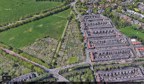
Project launched to increase tree population on Town Moor Land

North East Community Forest team, along with the Sheriff and Deputy Lord Mayor, Councillor Veronica Dunn and other representatives from Newcastle City Council and the Freemen of Newcastle launched the latest tree planting programme on the Town Moor.

The following news release was issued by Newcastle City Council:

“National Tree Week celebrates the wonderful world of trees and encourages more people in the area to get planting trees.

Queen’s Green Canopy

This ambitious project, which pays homage to the Queen’s Green Canopy: Plant a Tree for the Jubilee, will increase the tree population on Town Moor land by a total of 411 trees and 2,875 hedgerow plants, over 10 Town Moors by the end of the 2023 planting season (31 March 2023). It is planned to undertake many more tree planting projects on the Town Moors between the Freemen, Newcastle City Council, and the North East Community Forest Team in the near future.

Improving green spaces

Cllr Jane Byrne, Newcastle City Council’s Connect City Cabinet Member, said:

“The work of The North East Community Forest is key to creating more sustainable communities for the people of Newcastle and beyond.

“It is great that we are able to partner with the Freemen on this project which will have a positive impact on people’s health and wellbeing, create new habitats for wildlife, and help to improve air quality.”

David Wilson, Chair of the Freemen of Newcastle upon Tyne said:

“I am delighted to be partnering with the North East Community Forest to grow Newcastle’s urban forest on our latest planting project. Improving the city’s green spaces is a key priority for the Freeman and is vital for the health and wellbeing of the people who use them both now and into the future.” 

Lloyd Jones, Forest Manager, North East Community Forest said:

“It brings me significant pleasure and excitement to be partnering with Newcastle City Council and the Freemen of Newcastle upon Tyne on this scheme. The project provides an opportunity to plant trees and hedgerows where most people live, work and travel, and will therefore bring a suite of co-benefits to our communities and urban wildlife”

Trees greatly benefit the people living around them by having a positive impact on mental health and wellbeing, reducing stress and encouraging outdoor exercise. This is in addition to the benefits they will receive from an improved environmental quality and improved amenity which comes with planted areas

Funding for the project is being provided via the North East Community Forest Trees for Climate grant with in-kind contributions provided by the Freemen. The tree planting across the 7 Town Moor sites this season will be a mix of urban greenspace planting, wood pasture, and fruit trees and all trees planted will be recognised as part of The Queens Green Canopy.

Find out more: North East Community Forest | Newcastle City Council

The above news story was issued by Newcastle City Council and is available to read on the Newcastle City Council website. It has been included here for information and does not necessarily represent the views of High West Jesmond Residents’ Association. 

Moorfield – council developing plans designed to improve the neighbourhood

Newcastle City Council has announced that it is developing plans designed to improve neighbourhoods across the city.

Council leaflet

A leaflet from Newcastle City Council has been posted through letterboxes in High West Jesmond.

The city council leaflet says:

We will update you soon on proposals for your area to reduce traffic levels and make local streets safer.  This could include introducing new crossings, trialling the closure of through routes to vehicles by using large planters or bollards to restrict access at certain places, tightening junctions to reduce traffic speeds and introducing School Streets that mean people can’t park outside schools at pick up or drop off times.

We believe that making these changes will help create safer, clearner and greener neighbourhoods.  We’re asking residents to get in touch with us to tell us about any issues you would like us to consider using the contact details below.  Please tell us by 20 February 2022 to help us tackle the issues that matter to you.

Go to newcastle.gov.uk/neighbourhoods for more information

Email neighbourhoods@newcastle.gov.uk

Or call 0191 278 2767.

Transport Team, Newcastle City Council.”

Neighbourhood page on council website

The following news release was also issued by Newcastle City Council:

Making changes in the city to create safer, cleaner and greener neighbourhoods 

We are developing plans to improve neighbourhoods across the city, aimed at reducing traffic on local streets. With less vehicles cutting or speeding through streets the area will be more attractive and safer for people who live there and for children to play. These types of changes also encourage more people to walk and cycle on short local journeys, which is good for everybody.

We recently set out proposals for parts of the city including Arthur’s Hill, Fenham and Heaton and we intend to roll this programme out to more areas (see information below). To help us develop proposals, we are asking residents to tell us about any issues or concerns we need to consider.

Moorfield, Five Admirals and West Jesmond

We will update you soon on proposals for your area to reduce traffic levels and make local streets safer. Please email us at neighbourhoods@newcastle.gov.uk or call 0191 278 2767 to tell us about further issues we need to consider. Please tell us by 20 February to help us tackle the issues that matter to you.

Some of the issues that have previously been raised include:

Moorfield

  • Speeding and traffic levels on Moorfield and neighbouring streets;
  • Vehicles cutting through to and from Station Road on to Jesmond Dene Road and Ilford Road; and
  • Vehicles also using the access onto the Great North Road as a means to avoid queuing on Jesmond Dene Road at the roundabout at the Great North Road.

Five Admirals

  • School related congestion at drop off and pick up times in the vicinity of South Gosforth First School;
  • Speeding and traffic levels on streets around Beatty Avenue, Sturdee Gardens and Keyes Gardens and the residential streets that connect them; and
  • Vehicles cutting through Beatty Avenue and surrounding streets to and from Matthew Bank/Jesmond Dene Road to avoid queuing traffic.

West Jesmond

  • School related congestion at drop off and pick up times in the vicinity of West Jesmond Primary and other schools in the area;
  • Speeding and traffic levels on residential streets West of Osborne Road;
  • Commuter parking in existing permit parking areas; and
  • Speeding and traffic levels on Clayton Road and neighbouring residential streets.


The above consultation was issued by Newcastle City Council and is available to read on the Newcastle City Council website. It has been included here for information and does not necessarily represent the views of High West Jesmond Residents’ Association. 

Council confirms traffic restrictions on five bridges to be made permanent

Decisions to permanently close five local bridges to traffic are confirmed by Newcastle City Council

The following news release was issued by Newcastle City Council:

Vehicles have been restricted from using Salters Bridge in Gosforth, Castle Farm Road next to Jesmond Dene, Haldane Bridge in South Jesmond, Argyle Street bridge in Ouseburn, and Stoneyhurst Road Bridge in South Gosforth for just under 18 months, to re-allocate the road space for walking and cycling as part of the council’s response to the pandemic and in line with government’s expectations of councils and local policies to promote active travel.

Cllr Ged Bell, cabinet member for development, neighbourhoods, and transport said:

“We’re committed to creating safer, cleaner and greener neighbourhoods and the closure of these bridges to traffic is a part of achieving this.

“We recognise that public opinion has been split on this, as it often is with measures that prioritise or provide more space for active travel. The closure of some bridges to traffic have been more warmly welcomed than others, but we believe it is the right thing to do to create better neighbourhoods which put people first.”

Cllr Clare Penny-Evans, cabinet member for climate change and public safety said,

“The principle of this programme is really simple and is something we want to roll out across the city. Neighbourhoods should be places people can access by vehicle if they need to, but being able to cut through local streets means people do that, and it makes our neighbourhoods more dangerous. 

“Salters Bridge is a perfect example of this, where we saw many large HGVs navigate over a weak medieval structure, which we had to repeatedly issue warnings on. The closure of this bridge has stopped those vehicles thundering through quiet streets, making the area safer for everyone, particularly for children who can have a sense of playing in their local streets just as many older residents did, before streets were taken over by vehicles.”

Cllr John-Paul Stephenson said,

“We’ve seen the report on air pollution around schools and the dreadful health impact poor air quality can have on children. It is initiatives such as these that will encourage more people out of their cars to walk and cycle on local journeys and improve everyone’s health.”

Cllr Bell added,

“We’ve taken the time to thoroughly review the impact of the closures on local communities and I am satisfied that keeping the bridges closed to traffic supports our policies on transport, tackling air pollution and improving public health, as well as meeting our statutory duties.

“We will press on with our plans to expand more of these initiatives across the city and introducing School Streets following successful trials. Thousands of people will have received leaflets recently in areas across the city inviting them to raise issues in their local areas so we can include them in our thinking.  These types of schemes are important as they ensure local streets are designed for people, and not dominated by vehicles, cleaning up our air and improving our health and wellbeing.”

Experimental Traffic Regulation Orders (ETROs

Using Experimental Traffic Regulation Orders (ETROs), the council re-allocated the road space for people walking and cycling last August, due to the many schools and amenities in the local areas and the environmental and health benefits this brings.

A public consultation ran in the first six months of the closure which generated 42,000 contributions.

These were used to inform the decision-making process, alongside other factors such as traffic levels on surrounding streets, traffic speeds, how many people have been using the bridges for walking and cycling and air quality where monitors are in place.

Minor works near Stoneyhurst Bridge

The review concluded that all five bridges should remain permanently closed, with the potential for some further minor works near Stoneyhurst Bridge to address the concerns of people living east of the bridge.

This work includes improving the visibility from Dene Crescent onto Haddricks Mill Road as well as potentially introducing a one-way system on four of the surrounding streets.

All of the bridges reported good levels of walking and cycling in the area while the impact on the surrounding road network was manageable and there was no indication of a negative impact on road safety.

Discussions have also taken place with emergency services which only raised a potential issue with the closures of Argyle Street Bridge, but following further work those concerns have been addressed.

As a follow up to the closure to the bridges, further proposals for low traffic neighbourhoods in Arthur’s Hill, Fenham and Heaton were launched in November, for people to feedback on any potential issues they may foresee ahead of the council implementing changes in early 2022. Comments received from residents are currently being reviewed, which will inform the final designs of the scheme.

The council are working on a rolling programme of low traffic neighbourhoods across the city with further schemes to be released in the coming weeks, including Jesmond, Shieldfield, West Fenham, Kenton and Ouseburn Valley.

Reports setting out the Delegated Decisions for each of the five bridges is published here 

Argyle St – https://democracy.newcastle.gov.uk/ieDecisionDetails.aspx?ID=10801

Haldane – https://democracy.newcastle.gov.uk/ieDecisionDetails.aspx?ID=10799

Dene Bridge / Castle Farm Rd – https://democracy.newcastle.gov.uk/ieDecisionDetails.aspx?ID=10798

Stoneyhurst – https://democracy.newcastle.gov.uk/ieDecisionDetails.aspx?ID=10802

Salters Bridge- https://democracy.newcastle.gov.uk/ieDecisionDetails.aspx?ID=10800

Further information on low traffic neighbourhoods can be found at www.newcastle.gov.uk/neighbourhoods

The above news story was issued by Newcastle City Council and is available to read on the Newcastle City Council website. It has been included here for information and does not necessarily represent the views of High West Jesmond Residents’ Association.